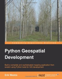
Python Geospatial Development

Book Details:
| Publisher: | Packt Publishing |
| Series: | Packt |
| Author: | Erik Westra |
| Edition: | 1 |
| ISBN-10: | 1849511543 |
| ISBN-13: | 9781849511544 |
| Pages: | 508 |
| Published: | Dec 14 2010 |
| Posted: | Nov 19 2014 |
| Language: | English |
| Book format: | |
| Book size: | 24.63 MB |
Book Description:
This is a tutorial style book that will teach usage of Python tools for GIS using simple practical examples and then show you how to build a complete mapping application from scratch. The book assumes basic knowledge of Python. No knowledge of Open Source GIS is required. This book is useful for Python developers who want to get up to speed with Open Source GIS in order to build GIS applications or integrate Geo-Spatial features into their applications.
Download Link:
Related Books:
Python Geospatial Analysis Cookbook
Over 60 recipes to work with topology, overlays, indoor routing, and web application analysis with Python About This Book * Explore the practical process of using geospatial analysis to solve simple to complex problems with reusable recipes * Concise step-by-step instructions to teach you about projections, vector, raster, overlay, indoor routing and topology analysis * Create a basic indoor routing application with geodjango Who This Book Is For If you are a student, teacher, programmer, geospatial or IT administrator, GIS analyst, researcher, or scientist looking to do spatial analysis, then this book is for you. Anyone trying to answer simple to complex spatial analysis questions will get a working demonstration of the power of Python with rea...
Python Web Development with Django
Using the simple, robust, Python-based Django framework, you can build powerful Web solutions with remarkably few lines of code. In Python Web Development with Django, three experienced Django and Python developers cover all the techniques, tools, and concepts you need to make the most of Django 1.0, including all the major features of the new release. The authors teach Django through in-depth explanations, plus provide extensive sample code supported with images and line-by-line explanations. You'll discover how Django leverages Python's development speed and flexibility to help you solve a wide spectrum of Web development problems and learn Django best practices covered nowhere else. You'll build your first Django application in just minutes and...
Learning Geospatial Analysis with Python
Master GIS and Remote Sensing analysis using Python with these easy to follow tutorials Overview Construct applications for GIS development by exploiting Python Focuses on built-in Python modules and libraries compatible with the Python Packaging Index distribution system- no compiling of C libraries necessary This is a practical, hands-on tutorial that teaches you all about Geospatial analysis in Python In Detail Geospatial analysis is used in almost every field you can think of from medicine, to defense, to farming. It is an approach to use statistical analysis and other informational engineering to data which has a geographical or geospatial aspect. And this typically involves applications capable of geospatial display and processing to get a co...
2007 - 2021 © eBooks-IT.org


