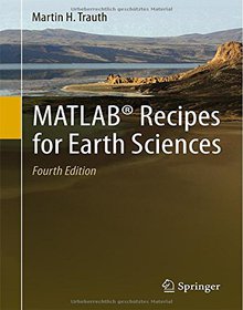
MATLAB Recipes for Earth Sciences
4th Edition

Book Details:
| Publisher: | Springer |
| Series: | Springer |
| Author: | Martin Trauth |
| Edition: | 4 |
| ISBN-10: | 3662462435 |
| ISBN-13: | 9783662462430 |
| Pages: | 427 |
| Published: | Apr 13 2015 |
| Posted: | Jun 02 2015 |
| Language: | English |
| Book format: | |
| Book size: | 21.34 MB |
Book Description:
MATLAB is used for a wide range of applications in geosciences, such as image processing in remote sensing, the generation and processing of digital elevation models and the analysis of time series. This book introduces methods of data analysis in geosciences using MATLAB, such as basic statistics for univariate, bivariate and multivariate datasets, time-series analysis, signal processing, the analysis of spatial and directional data and image analysis. The revised and updated Fourth Edition includes sixteen new sections and most chapters have greatly been expanded so that they now include a step by step discussion of all methods before demonstrating the methods with MATLAB functions. New sections include: Array Manipulation; Control Flow; Creating Graphical User Interfaces; Hypothesis Testing; Kolmogorov-Smirnov Test; Mann-Whitney Test; Ansari-Bradley Test; Detecting Abrupt Transitions in Time Series; Exporting 3D Graphics to Create Interactive Documents; Importing, Processing and Exporting LANDSAT Images; Importing and Georeferencing TERRA ASTER Images; Processing and Exporting EO-1 Hyperion Images; Image Enhancement; Correction and Rectification; Shape-Based Object Detection in Images; Discriminant Analysis; and Multiple Linear Regression. The text includes numerous examples demonstrating how MATLAB can be used on data sets from earth sciences. The books supplementary electronic material (available online through Springer Link) includes recipes that include all the MATLAB commands featured in the book and the example data.
Download Link:
Related Books:
MATLAB Recipes for Earth Sciences
MATLAB is used in a wide range of applications in geosciences, such as image processing in remote sensing, generation and processing of digital elevation models and the analysis of time series. This book introduces basic methods of data analysis in geosciences using MATLAB. The text includes a brief description of each method and numerous examples demonstrating how MATLAB can be used on data sets from earth sciences. All MATLAB recipes can be easily modified in order to analyse the reader's own data sets. The book comes with a CD containing exemplary data sets and a digital version of the MATLAB recipes....
Fuzzy Cognitive Maps for Applied Sciences and Engineering
From Fundamentals to Extensions and Learning Algorithms
Fuzzy Cognitive Maps (FCM) constitute cognitive models in the form of fuzzy directed graphs consisting of two basic elements: the nodes, which basically correspond to concepts bearing different states of activation depending on the knowledge they represent, and the edges denoting the causal effects that each source node exercises on the receiving concept expressed through weights. Weights take values in the interval [-1,1], which denotes the positive, negative or neutral causal relationship between two concepts. An FCM can be typically obtained through linguistic terms, inherent to fuzzy systems, but with a structure similar to the neural networks, which facilitates data processing, and has capabilities for training and adaptation.During the last 10 ...
20 Recipes for Programming PhoneGap
Cross-Platform Mobile Development for Android and iPhone
Gain hands-on experience with the amazing PhoneGap library, using the practical recipes in this handy guide. With these solutions, you can enable your mobile web apps to interact with device-specific features such as the accelerometer, GPS, camera, and address book. Learn how to use your knowledge of HTML, CSS, and JavaScript to build full mobile apps for iOS, Android, and several other platforms without rewriting apps in the native platform language. Each recipe includes sample code you can use in your project right away, as well as a discussion of why the solution works. Add functionality that's available only on a certain device or platform Retrieve the device's current GPS location and place a marker on a map Create and save a new contact or edit...
2007 - 2021 © eBooks-IT.org


