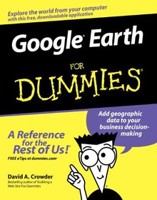
Google Earth
For Dummies

Book Details:
| Publisher: | For Dummies |
| Series: | Wiley , For Dummies |
| Author: | David A. Crowder |
| Edition: | 1 |
| ISBN-10: | 0470095288 |
| ISBN-13: | 9780470095287 |
| Pages: | 360 |
| Published: | Feb 27 2007 |
| Posted: | Nov 19 2014 |
| Language: | English |
| Book format: | |
| Book size: | 20.18 MB |
Book Description:
This interesting guide covers all aspects of Google Earth, the freely downloadable application from Google that allows users to view satellite images from all points of the globeAimed at a diverse audience, including casual users who enjoy air shots of locales as well as geographers, real estate professionals, and GPS developersIncludes valuable tips on various customizations that users can add, advice on setting up scavenger hunts, and guidance on using Google Earth to benefit a businessExplains modifying general options, managing the layer and placemark systems, and tackling some of the more technical aspects, such as interfacing with GPSThere are more than 400,000 registered users of Google Earth and the number is still growing
Download Link:
Related Books:
Deconstructing the Elements with 3ds Max
Create natural fire, earth, air and water without plug-ins
2nd Edition
Get the most realistic effects from 3ds Max without having to spend more on plug-ins!Boost your effects skill-set with this 3ds Max workshop. Tutorial lessons give you hands-on experience in creating realistic fire, earth, air and water effects. Updated to demonstrate production techniques suitable for any version of 3ds Max, this new edition is co-published by Autodesk Media and Entertainment, and includes new tutorials on entering the Earth's atmosphere, glaciers, lava eruptions and a Badlands landscape.Inspirational color images cover every page of the book as the author shares his professional techniques and workflow processes. The companion DVD co...
MATLAB Recipes for Earth Sciences
MATLAB is used in a wide range of applications in geosciences, such as image processing in remote sensing, generation and processing of digital elevation models and the analysis of time series. This book introduces basic methods of data analysis in geosciences using MATLAB. The text includes a brief description of each method and numerous examples demonstrating how MATLAB can be used on data sets from earth sciences. All MATLAB recipes can be easily modified in order to analyse the reader's own data sets. The book comes with a CD containing exemplary data sets and a digital version of the MATLAB recipes....
MATLAB Recipes for Earth Sciences
4th Edition
MATLAB is used for a wide range of applications in geosciences, such as image processing in remote sensing, the generation and processing of digital elevation models and the analysis of time series. This book introduces methods of data analysis in geosciences using MATLAB, such as basic statistics for univariate, bivariate and multivariate datasets, time-series analysis, signal processing, the analysis of spatial and directional data and image analysis. The revised and updated Fourth Edition includes sixteen new sections and most chapters have greatly been expanded so that they now include a step by step discussion of all methods before demonstrating t...
2007 - 2021 © eBooks-IT.org


